Is Inwangsan an Easy Hike for First-Time Visitors?
Table of Contents
- Is Inwangsan an easy hike for beginners?
- Which Inwangsan route should you choose?
- What is the climb like on the trail?
- What can you see from Inwangsan?
- How should you prepare for an easier hike?
- Common planning mistakes to avoid
- Should you hike Inwangsan or choose another Seoul walk?
- Frequently Asked Questions
- Key takeaway
Is Inwangsan an easy hike for first-time visitors? It can be, if you are comfortable walking uphill and on uneven paths. The mountain is close to central Seoul and has short mapped routes, but some sections include steep steps, rocks, or a substantial incline, so expect a real hike rather than a flat city stroll.
Is Inwangsan an easy hike for beginners?
Inwangsan is a short, manageable mountain outing with sections that ask for more effort. Seoul Hiking Tourism maps a 1.84-kilometer route from Dongnimmun Gate through Inwangsa Temple, Seonbawi Rock, and Beombawi Rock to the summit. That compact distance makes it possible to plan a focused outing, but it does not mean every part of the climb is gentle.
Difficulty depends on the trail you choose. Seoul’s Hiking Guidebook rates the Hongje Yuyeon–Gaemi Maeul–Gichabawi Rock route to the summit as average. It covers 2.5 kilometers and has an average travel time of 1 hour 20 minutes; those figures describe that course, not all routes on Inwangsan.
| What to expect | What it means for a first-time hiker |
|---|---|
| Short mapped routes | You can make the mountain the main activity for part of a day instead of committing to a long excursion. |
| Uphill and rocky sections | Wear shoes that grip well and slow down where the slope or footing becomes more demanding. |
| Different route ratings | Use the route’s own distance and difficulty rating rather than relying on a single label for the mountain. |
| Named landmarks along the way | Use the landmarks on your chosen map to check that you are following the intended trail. |
If you already walk regularly and feel steady on uneven paths, the climb may feel approachable. If you rarely hike, are short on time, or are with someone who needs frequent rests, plan for a slower outing and treat turning back before the summit as a valid option.
Which Inwangsan route should you choose?
Choose a route by its starting point, terrain, and finish—not just its distance. The Seoul Hiking Tourism map and Seoul’s Hiking Guidebook describe different courses, so their route details should not be combined as though they were one continuous trail.
| Route | Published details | Could suit |
|---|---|---|
| Dongnimmun Gate to Inwangsan summit | Seoul Hiking Tourism maps the route via Inwangsa Temple, Seonbawi Rock, and Beombawi Rock; the mapped distance is 1.84 km. | Hikers who want a direct climb with clearly named landmarks. |
| Hongje Yuyeon to the summit | Seoul’s Hiking Guidebook lists 2.5 km, average difficulty, and an average travel time of 1 hour 20 minutes. The route passes Gaemi Maeul and Gichabawi Rock. | Hikers who prefer a route described as a mix of boardwalk and dirt trail. |
| Sajikdan Altar to Yoon Dong-ju Literature Museum | Seoul Hiking Tourism lists Dangunseongjeon Shrine, Hwanghakjeong Pavilion, Mumudae Observatory, and Seosijeong Pavilion along the route. | Visitors interested in following a series of named cultural and viewpoint stops. |
For the Hongje Yuyeon course, the city guide describes boardwalks and dirt trails with gentle ascents and descents. It also says there are no stores along that route and recommends bringing drinking water. This makes it a useful option to plan in advance rather than treating it as a walk where you can count on buying supplies on the way.
A travel guide describes Sajikdan Altar as a practical trailhead near central Seoul: it gives a walk of about 15 minutes from Gyeongbokgung Palace and about five minutes from Exit 1 of Gyeongbokgung Station. If you plan to start there, use the route name and first landmark from your map to verify that you are heading toward the course you intended.
What is the climb like on the trail?
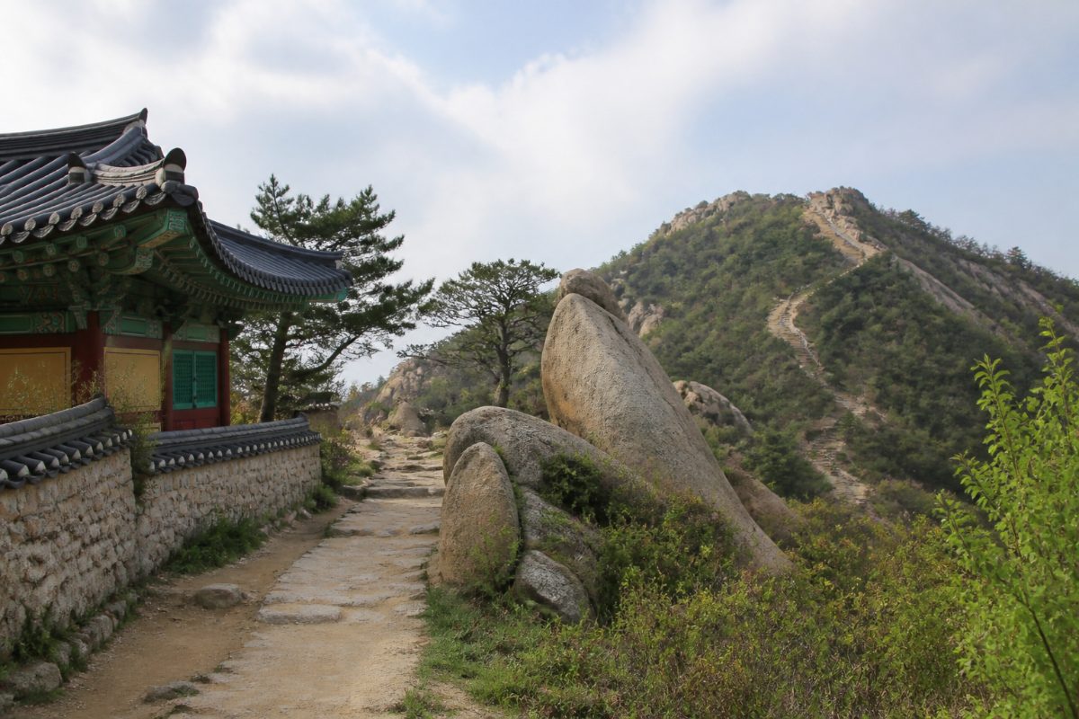
Expect a transition from city streets to a mountain path, then steady uphill walking with some places where footing deserves extra attention. Seoul’s Hiking Guidebook describes the Hongje Yuyeon course as boardwalk and dirt trail, and notes a substantial incline on an approach near the summit. The experience can therefore feel more strenuous than a short distance on a flat map suggests.
Distance tells you how far a route goes; it does not tell you how steep or uneven the surface is. Seoul’s guidebook rates the 2.5-kilometer Hongje Yuyeon course as average, while the 1.84-kilometer Dongnimmun Gate route is a separate mapped option. Treat the ratings and measurements as route-specific, and plan your pace around the ground rather than assuming the shorter route will feel effortless.
- Before setting out, match your map to the route’s actual starting point and first named landmark.
- Walk uphill at a pace that lets you place your feet securely; pause where there is room to stop safely.
- At a viewpoint or the summit, check your planned descent before continuing. A mapped route to the summit does not by itself tell you which way you will return.
- Allow time for the way down as well as the ascent, especially if you expect to stop for photographs or rests.
On steeper ground, a controlled pace is more useful than trying to keep a fast walking rhythm. Shoes with a stable sole help you feel secure on dirt, rock, and steps; the city guide says hiking boots are not necessary for the Hongje Yuyeon course, but it still recommends carrying water. Choose footwear that feels supportive to you rather than treating specialized boots as a requirement for every route.
What can you see from Inwangsan?
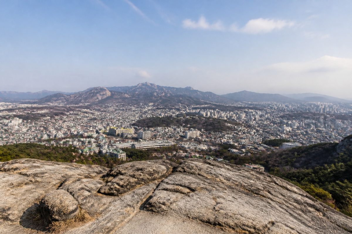
The summit and upper trail offer views across Seoul, including Gyeongbokgung Palace, Namsan Tower, and parts of Bukhansan. A view of the city from a mountain gives the climb a different perspective from sightseeing at street level, and the trail includes named points such as Beombawi Rock and Mumudae Observatory that help you understand where you are along your chosen route.
Visibility affects how much of the skyline you can see, so think of the panorama as a possible reward rather than the only reason to hike. Build in time to pause at a viewpoint, take in the surrounding landscape, and check your route before moving on. If the summit is not comfortable for your group, a lower viewpoint can still make a worthwhile stopping point.
Inwangsan is also a practical choice for a visitor who wants to combine a mountain walk with central Seoul sightseeing. The Sajikdan starting area is within walking distance of Gyeongbokgung Palace, according to the travel guide that describes that trailhead. Keep the rest of the day flexible: a climb, a descent, and time at nearby sights can feel like a fuller outing than the trail distance alone suggests.
How should you prepare for an easier hike?
Carry drinking water, wear comfortable shoes with a secure grip, and save the exact route before leaving. Water is especially relevant on the Hongje Yuyeon course because Seoul’s Hiking Guidebook states that there are no stores along the way. Knowing the route’s start and finish also helps you avoid assuming that all trail maps describe the same approach.
- First-time hiker: Pick one mapped course, leave room for rests, and do not add another trail simply because the distance looks short.
- Regular walker: The Dongnimmun Gate route offers a compact mapped approach with named landmarks, but still plan for uphill effort and uneven footing.
- Group with mixed fitness: Agree on a comfortable pace and a point where anyone can pause or turn back. The summit does not need to be the sole measure of a successful outing.
- Photo-focused visitor: Include time for viewpoint stops and for checking the return route. The time listed for a course does not include every group’s personal pace or photo breaks.
- Visitor choosing the Hongje Yuyeon route: Pack water before reaching the trail because the guidebook says there are no stores along this course.
Check the surface and your comfort level on the day. If rain, snow, or another condition has made the path slippery, a trail description that is usually manageable does not tell you that the footing is suitable at that moment. Choose a different activity if the conditions make you feel unsteady.
Common planning mistakes to avoid
The most common mistake is reading “beginner-friendly” as “flat and paved.” Inwangsan is accessible as a city hike, but its routes include uphill terrain, and some approaches have steeper sections. Look at the route description and landmarks before you decide whether it matches your walking experience.
- Choosing by mountain name alone: Compare the specific route, since the Dongnimmun Gate and Hongje Yuyeon courses have different mapped distances and descriptions.
- Assuming a summit route is a loop: Check the return plan separately. The Seoul Hiking Tourism map describes the Dongnimmun Gate approach to the summit through named landmarks; make sure your map also shows how you will descend.
- Leaving water until you reach the trail: The Seoul guidebook says there are no stores on the Hongje Yuyeon route, so bring water before starting that course.
- Planning only for the ascent: The descent is part of the hike. Leave time for it and avoid scheduling the next activity so tightly that you feel rushed on the trail.
- Expecting a guaranteed clear view: The city panorama is a highlight, but visibility can affect what appears in the distance. Enjoy the trail and its landmarks as well as the skyline.
For current route details, consult Seoul Hiking Tourism’s Inwangsan trail map and match its start and finish points to your plan. For the Hongje Yuyeon course, Seoul’s Hiking Guidebook provides the distance, difficulty rating, average travel time, and practical notes on the path.
Should you hike Inwangsan or choose another Seoul walk?
Choose Inwangsan if you want an actual mountain climb, a summit viewpoint, and a route close to central Seoul. It is less suitable if your priority is a completely flat walk or if your group is not comfortable with uneven ground. For another beginner-oriented option, compare it with beginner-friendly hiking trails in South Korea.
If you want a longer mountain outing, compare trail descriptions before settling on a route. Bukhansan offers a different Seoul-area hiking choice. If you choose Inwangsan, keep the itinerary around light enough to enjoy the climb and the walk back down.
Frequently Asked Questions
How long does it take to hike Inwangsan?
There is no single time for every Inwangsan route. Seoul’s Hiking Guidebook lists an average travel time of 1 hour 20 minutes for the 2.5-kilometer Hongje Yuyeon course; that figure applies to that route, and your pace and stops affect your day plan.
Is Inwangsan suitable for someone who has never hiked?
It can suit a first-time hiker who is comfortable walking uphill and on uneven ground. Choose a mapped route, wear stable shoes, and give yourself the option to pause or turn back if the terrain feels uncomfortable.
Do I need hiking boots for Inwangsan?
Seoul’s Hiking Guidebook says hiking boots are not necessary for the Hongje Yuyeon route. It describes boardwalk and dirt trail, so comfortable shoes with a secure grip are a practical choice; the guidebook also recommends bringing drinking water.
Is the Dongnimmun Gate route a loop?
Seoul Hiking Tourism maps the route from Dongnimmun Gate through Inwangsa Temple, Seonbawi Rock, and Beombawi Rock to the summit. Plan your descent separately rather than assuming that the mapped approach automatically forms a loop.
Key takeaway
Inwangsan is a realistic first Seoul mountain for visitors who are comfortable with uphill walking, but it is not a flat or effortless stroll. Compare the route’s start point, terrain, and mapped distance; bring water for the Hongje Yuyeon course; and leave enough time for both the climb and descent. Save the exact route and return plan before you start so you can focus on the trail and the views.
References
- How to Hike Inwangsan: Best Route, Fortress Wall Trail & Sunset Views in Seoul – The Girl with a Big Bag
- INWANGSAN Trail
- SEOUL HIKING GUIDE BOOK
- Hiking Korea: Inwangsan Mountain Hiking Guide – The Best View in Seoul
- 10 Best Mountains to Hike in Seoul for Foreign Tourists: Easy, Moderate & Challenging Trails - koreareadyguide
- Hiking in Seoul: Inwangsan and Bugaksan
- Complete Inwangsan Hiking Guide: Trail Maps, Difficulty & Scenic Views in Seoul
Information in this post was checked as of November 2026. Policies and prices may change, so please verify important details with official sources.


Comments
Post a Comment